Extreme Weather
Understanding Severe Weather
 Thunderstorms
A thunderstorm is simply a storm that produces thunder and lightening, and usually strong wind and rain. As the warm air rises, clouds form and the air cools. As it cools it releases heat causing the air to rise even further.
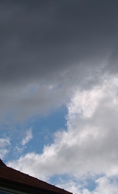
In unstable atmospheric conditions, this process will continue forming cumulonimbus clouds which can generate thunder and lightening. All thunderstorms go through the same process: cumulus stage, mature stage and dissipation stage.
- Cumulus stage In this stage masses of humid air are lifted upwards. As this moisture cools it forms into drops of water and forms cumulus clouds. This process releases even more heat which also creates further updrafts
- Mature stage In the mature stage the warm air rises until it reaches a ceiling which is usually the tropopause (top of the troposphere). There the air spreads out. The water droplets freeze, melting as they fall to become rain. Sometimes if there is sufficient updraft they are held up long enough not to melt and will fall as hail. If both up and downdrafts are occurring there is a large degree of turbulence which causes lightening and strong winds (and in some cases tornadoes).
- Dissipation stage In this stage the storm is dominated by the downdraft, which reaches down to the surface and spreads out cutting of any warm air moving upwards. The updraft then stops and the thunderstorm will slowly disappear.
Tropical Cyclones (TC)
Tropical cyclones (also known as hurricanes in the northern hemisphere) are the largest storms on Earth. As the name suggests TCs form almost exclusively in the tropics where the warm water is integral to their formation. TCs are notably different from other storms due to strong convection effect that drives them.
The energy for these storms comes from the release of the heat of condensation (or latent heat) of large quantities of warm humid air. This release of heat to the surrounding atmosphere warms the air causing it to rise. This has a result of lowering surface air pressure causing more air to rush in and cyclonic circulation to start. At the top of the storm, the air is cooling and diverging (spreading out). Eventually the air will cool enough to descend. Note that as the pressure lowers at the centre the pressure difference increases.
All TCs are low pressures systems. The air pressure in TCs has been the lowest ever recorded on Earth. TCs may range from about 200km in radius to over 900km. At the centre of a cyclone is the eye. This is an area of descending air with calm weather and clear skies. It may vary in size from 3km to over 350km in radius. The eyewall is the area of strongest winds.
Tornadoes
Tornadoes are short intense, very destructive local storms. They are windstorms caused by a severe type of thunderstorm known as a supercell. A supercell is a thunderstorm that has a mesocyclone which is a rotating upshaft at its centre. As well as tornadoes, these supercell storms will have very heavy rain, lightening and hail with them. A tornado forms as the heavy rain drags air down with it creating what is known as a rear flank downdraft. This downdraft drags the mesocyclone downward to the ground. As the mesocyclone descends a condensation funnel appears, at the same time the RFD hits the ground. Usually the funnel becomes a tornado which may last for just a few minutes or for more than one hour. Eventually the rear flank downdraft will wrap around the tornado and cut of the warm air which was feeding the cyclone.
[20/04/2024 20:26:53]